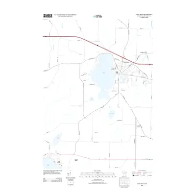
2013 Map of Lake Mills
USGS Topo · Published 2013About this map
Rock Lake anchors this part of Jefferson County, with the city of Lake Mills positioned along its eastern shore. The street grid of the town is well-established, showing a density of development near W Madison St and S Ferry Dr that contrasts with the surrounding agricultural land. To the northeast, the presence of Hoopers Mill along the Crawfish River suggests an industrial history tied to local waterways. The landscape is dotted with numerous smaller glacial features including Bean Lake, Mud Lake, and Hope Lake. To the south, the settlement at Lake Ripley and the residential area of Breezy Knoll illustrate the importance of these water bodies for local community planning and recreation. Transportation is defined by the high-speed corridor of I-94 cutting across the north and Us-18 running through the southern section near the Ha-Rail Airport.
Find a feature on this map
73 named features on this map. Tap any name to fly to it.
Don’t see what you’re looking for? This feature index may not catch every label — zoom into the map to look around manually.
Map Details
Editions of this 2013 Lake Mills Map
This is the sole edition of this map. No revisions or reprints were ever made.
Other maps of this area

1890 · Sun Prairie
USGS Topo · 1:62,500

1890 · Stoughton
USGS Topo · 1:62,500

1891 · Waterloo
USGS Topo · 1:62,500

1891 · Koshkonong
USGS Topo · 1:62,500

1894 · Waterloo
USGS Topo · 1:62,500

1894 · Koshkonong
USGS Topo · 1:62,500

1896 · Sun Prairie
USGS Topo · 1:62,500

1905 · Sun Prairie
USGS Topo · 1:62,500

1906 · Koshkonong
USGS Topo · 1:62,500

1907 · Sun Prairie
USGS Topo · 1:62,500