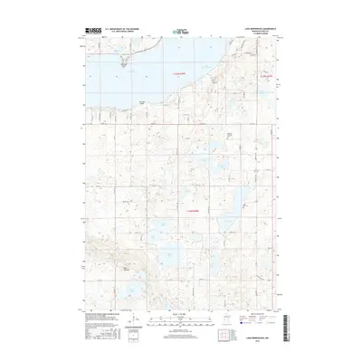
2016 Map of Lake Minnewaska
USGS Topo · Published 2016About this map
Lake Minnewaska dominates the northern landscape of Pope County, defining the glacial character of this central Minnesota region. The shoreline features prominent landforms like Lawrence Point and Swenson Point, while the surrounding prairie is dotted with smaller water bodies including Celia Lake, Nelson Lake, and Lake Mary. This 2016 survey illustrates a rural landscape where section-line roads like Co RD 18 and State HWY 104 connect scattered farmsteads and points of local heritage. Genealogical interest is centered on sites such as the Barsness Lutheran Cem and Lake Ben Cem, which anchor the history of the families who settled this lake-rich terrain. The southern portion of the sheet transitions to the distinct elevation of the Blue Mounds, overlooking a network of smaller lakes like Edwards Lake and Hoff Lake.
Find a feature on this map
67 named features on this map. Tap any name to fly to it.
Don’t see what you’re looking for? This feature index may not catch every label — zoom into the map to look around manually.
Map Details
Editions of this 2016 Lake Minnewaska Map
This is the sole edition of this map. No revisions or reprints were ever made.
Other maps of this area

1953 · Saint Cloud
USGS Topo · 1:250,000

1957 · Saint Cloud
USGS Topo · 1:250,000

1958 · Saint Cloud
USGS Topo · 1:250,000

1968 · Starbuck
USGS Topo · 1:24,000

1968 · Lowry
USGS Topo · 1:24,000

1968 · Glenwood
USGS Topo · 1:24,000

1968 · Terrace
USGS Topo · 1:24,000
1968 · Villard
USGS Topo · 1:24,000

1968 · Lake Hassel
USGS Topo · 1:24,000

1968 · Lake Simon
USGS Topo · 1:24,000