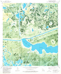
1980 Map of Lake Misere
USGS Topo · Published 1980About this map
Lacassine National Wildlife Refuge dominates the landscape of this Cameron Parish orthophotomap, where the wetlands of south Louisiana meet industrial resource extraction. The 1980 survey captures a complex network of man-made alterations to the marsh, including the prominent Intracoastal Waterway and the Bell City Drainage Canal. These waterways cut through the natural geography of Lake Misere and Little Lake Misere, connected by the narrow passage known simply as The Narrows.
Find a feature on this map
17 named features on this map. Tap any name to fly to it.
Don’t see what you’re looking for? This feature index may not catch every label — zoom into the map to look around manually.
Map Details
Editions of this 1980 Lake Misere Map
This is the sole edition of this map. No revisions or reprints were ever made.
Other maps of this area

1932 · Lake Charles SE
USGS Topo · 1:31,680

1934 · Catfish Lake
USGS Topo · 1:24,000

1934 · Lake Misere
USGS Topo · 1:24,000

1934 · Boudreaux Lake
USGS Topo · 1:24,000

1934 · Latania Lake
USGS Topo · 1:24,000

1935 · Lake Misere
USGS Topo · 1:31,680

1935 · Catfish Lake
USGS Topo · 1:31,680

1935 · Latania Lake
USGS Topo · 1:31,680

1935 · Boudreaux Lake
USGS Topo · 1:31,680

1935 · Bay Labauve
USGS Topo · 1:31,680