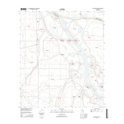
2015 Map of Lake Mongoulois
USGS Topo · Published 2015About this map
Bayou Chene sits at the heart of this complex riverine landscape, where the shifting waters of the Atchafalaya Basin define the boundary between Iberville Parish and St. Martin Parish. This 2015 study documents a labyrinth of natural and engineered waterways, from the broad expanse of Lake Mongoulois to specialized channels like the Blind Tensas Cut and Splice Island Chute. The map reveals the intricate drainage patterns of the Atchafalaya Basin Floodway, characterized by numerous named islands such as Splice Island and Cozine Island. Local history is reflected in the distinctively named water features like Bear Hundred Dollar Bayou and Little Devil Cut, which hint at the navigational challenges and traditional naming conventions of the Louisiana swamp. The grid of the Public Land Survey System overlays the fluid terrain, illustrating the intersection of formal land management with the dynamic hydrology of the Bayou De Plomb and Big Tensas Bayou systems.
Find a feature on this map
47 named features on this map. Tap any name to fly to it.
Don’t see what you’re looking for? This feature index may not catch every label — zoom into the map to look around manually.
Map Details
Editions of this 2015 Lake Mongoulois Map
This is the sole edition of this map. No revisions or reprints were ever made.
Other maps of this area

1935 · Osca Bayou
USGS Topo · 1:62,500

1935 · Chicot Lake
USGS Topo · 1:62,500

1940 · Grosse Tete
USGS Topo · 1:62,500

1941 · Loreauville
USGS Topo · 1:62,500

1953 · Cow Bayou
USGS Topo · 1:24,000

1953 · Pigeon Bay
USGS Topo · 1:24,000

1953 · Grosse Tete SW
USGS Topo · 1:24,000

1954 · Chicot Lake
USGS Topo · 1:62,500

1954 · Loreauville
USGS Topo · 1:62,500

1954 · Baton Rouge
USGS Topo · 1:250,000