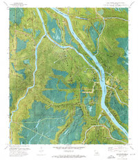
1973 Map of Lake Mongoulois
USGS Topo · Published 1976About this map
The Atchafalaya Basin Floodway dominates this mid-1970s orthophotomap, showing a complex landscape where water and industry meet in the Louisiana swamplands. The settlement of Doris sits near the western edge, while a sprawling Oil and Gas Field is evidenced by numerous sludge pits, oil wells, and drill holes scattered across the basin floor. This map captures the intricate network of the Upper Grand River and Lake Mongoulois, linked by engineered waterways like the Blind Tensas Cut and Little Devil Cut.
Find a feature on this map
59 named features on this map. Tap any name to fly to it.
Don’t see what you’re looking for? This feature index may not catch every label — zoom into the map to look around manually.
Map Details
Editions of this 1973 Lake Mongoulois Map
This is the sole edition of this map. No revisions or reprints were ever made.
Other maps of this area

1935 · Osca Bayou
USGS Topo · 1:62,500

1935 · Chicot Lake
USGS Topo · 1:62,500

1940 · Grosse Tete
USGS Topo · 1:62,500

1941 · Loreauville
USGS Topo · 1:62,500

1953 · Cow Bayou
USGS Topo · 1:24,000

1953 · Pigeon Bay
USGS Topo · 1:24,000

1953 · Grosse Tete SW
USGS Topo · 1:24,000

1954 · Chicot Lake
USGS Topo · 1:62,500

1954 · Loreauville
USGS Topo · 1:62,500

1954 · Baton Rouge
USGS Topo · 1:250,000