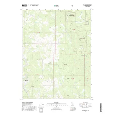
2018 Map of Lake Mountain
USGS Topo · Published 2018About this map
The Eel River defines the southwestern corner of this Trinity County landscape, winding past the settlement at Island Mountain. This mountainous terrain is characterized by a high-elevation drainage system feeding into numerous named creeks, including Kekawaka Cr and Queatchumpah Cr. The map reveals a high-country economy and infrastructure through labels like Hoaglin School Rd and Old School House Rd, suggesting the historical placement of rural community centers. Large portions of the territory are managed as part of the Six Rivers National Forest. Higher elevations are marked by prominent summits such as Lake Mountain and Pilot Peak, while more level areas like Pine Flat and Prather Flat provide rare breaks in the topography. Isolated water bodies like Turtle Lake and Dry Lake are scattered across the ridges, and the northern reaches are home to Kettenpom Valley and Hoaglin Valley.
Find a feature on this map
44 named features on this map. Tap any name to fly to it.
Don’t see what you’re looking for? This feature index may not catch every label — zoom into the map to look around manually.
Map Details
Editions of this 2018 Lake Mountain Map
This is the sole edition of this map. No revisions or reprints were ever made.
Other maps of this area

1920 · Cummings
USGS Topo · 1:62,500

1920 · Covelo
USGS Topo · 1:62,500

1920 · Harris
USGS Topo · 1:62,500

1921 · Hoaglin
USGS Topo · 1:62,500

1922 · Island Mountain
USGS Topo · 1:62,500

1931 · Hoaglin
USGS Topo · 1:96,000

1935 · Hoaglin
USGS Topo · 1:125,000

1949 · Alderpoint
USGS Topo · 1:62,500

1951 · Alderpoint
USGS Topo · 1:62,500

1952 · Spyrock
USGS Topo · 1:62,500