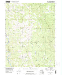
1996 Map of Lake Mountain
USGS Topo · Published 2000About this map
Six Rivers National Forest dominates this landscape in southern Trinity County, defined by its steep peaks and the winding course of the Eel River. The 1990s terrain is marked by remote ranching outposts and infrastructure, including the Lake Mountain Landing Strip and several high-elevation corrals such as Lone Pine Corrals and Pepperwood Corrals. The Northwestern Pacific railroad corridor follows the river's path, cutting through the southwestern corner near Island Mountain, where a notable Tunnel and several Mines suggest the historical industrial activity of the canyon.
Find a feature on this map
48 named features on this map. Tap any name to fly to it.
Don’t see what you’re looking for? This feature index may not catch every label — zoom into the map to look around manually.
Map Details
Editions of this 1996 Lake Mountain Map
This is the sole edition of this map. No revisions or reprints were ever made.
Other maps of this area

1920 · Cummings
USGS Topo · 1:62,500

1920 · Covelo
USGS Topo · 1:62,500

1920 · Harris
USGS Topo · 1:62,500

1921 · Hoaglin
USGS Topo · 1:62,500

1922 · Island Mountain
USGS Topo · 1:62,500

1931 · Hoaglin
USGS Topo · 1:96,000

1935 · Hoaglin
USGS Topo · 1:125,000

1949 · Alderpoint
USGS Topo · 1:62,500

1951 · Alderpoint
USGS Topo · 1:62,500

1952 · Spyrock
USGS Topo · 1:62,500