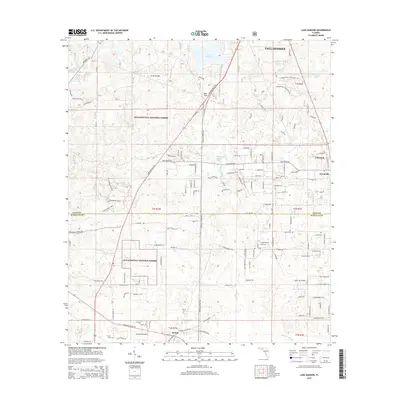
2015 Map of Lake Munson
USGS Topo · Published 2015About this map
The Apalachicola National Forest dominates the southwestern quadrant of this 2015 survey, revealing a landscape defined by distinctive karst topography and dense wetland drainages. The transition from the southern edge of Tallahassee into the rural stretches of Leon and Wakulla counties is marked by the presence of Lake Munson and the hydrological connectivity of Munson Slough and McBride Slough. Local history is anchored by the communities of Woodville and Bethel, while smaller clusters like Lutterloh sit near the eastern boundary. Genealogists may find value in the locations of Harvey Cem and Sutton Cem. The map highlights the unique geography of the Woodville Karst Plain through features such as Blue Sink, Riversink Spring, and Rock Sink, which illustrate the subterranean water systems prevalent in this part of Florida.
Find a feature on this map
140 named features on this map. Tap any name to fly to it.
Don’t see what you’re looking for? This feature index may not catch every label — zoom into the map to look around manually.
Map Details
Editions of this 2015 Lake Munson Map
This is the sole edition of this map. No revisions or reprints were ever made.
Other maps of this area

1940 · Tallahassee
USGS Topo · 1:62,500

1940 · Arran
USGS Topo · 1:62,500

1942 · Tallahassee
USGS Topo · 1:62,500

1943 · Arran
USGS Topo · 1:62,500

1943 · Tallahassee
USGS Topo · 1:62,500

1954 · Lafayette
USGS Topo · 1:24,000

1954 · Woodville
USGS Topo · 1:24,000

1954 · St. Marks
USGS Topo · 1:24,000

1954 · Tallahassee
USGS Topo · 1:250,000

1959 · Tallahassee
USGS Topo · 1:250,000