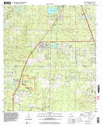
1999 Map of Lake Munson
USGS Topo · Published 2003About this map
Apalachicola National Forest dominates the southern reaches of this landscape, where the karst topography of North Florida reveals itself through a complex network of sinks and subterranean drainage. The Leon Sinks Geological Area and individual features like Blue Sink and Riversink Spring highlight the region's unique hydrology, where surface waters frequently vanish into the limestone below. To the north, the terrain transitions into the southern fringes of Tallahassee, bounded in part by the Tallahassee City Bdy.
Find a feature on this map
23 named features on this map. Tap any name to fly to it.
Don’t see what you’re looking for? This feature index may not catch every label — zoom into the map to look around manually.
Map Details
Editions of this 1999 Lake Munson Map
This is the sole edition of this map. No revisions or reprints were ever made.
Other maps of this area

1940 · Tallahassee
USGS Topo · 1:62,500

1940 · Arran
USGS Topo · 1:62,500

1942 · Tallahassee
USGS Topo · 1:62,500

1943 · Arran
USGS Topo · 1:62,500

1943 · Tallahassee
USGS Topo · 1:62,500

1954 · Lafayette
USGS Topo · 1:24,000

1954 · Woodville
USGS Topo · 1:24,000

1954 · St. Marks
USGS Topo · 1:24,000

1954 · Tallahassee
USGS Topo · 1:250,000

1959 · Tallahassee
USGS Topo · 1:250,000