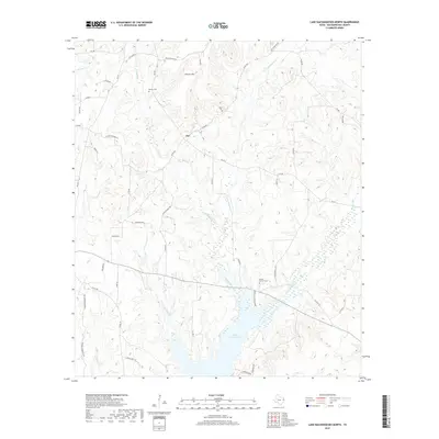
2019 Map of Lake Nacogdoches North
USGS Topo · Published 2019About this map
Lake Nacogdoches dominates the southern landscape of this East Texas region, its branching fingers fed by Bayou Loco and Yellow Bank Cr. The settlement of Nat sits at a central crossroads, surrounded by a complex network of county roads and drainage systems including Caney Cr and Little Bayou Loco. This 2019 survey illustrates the rural character of northern Nacogdoches County, where the terrain is marked by significant rises such as Flower Mtn. For those documenting local family history, the map identifies specific burial sites including Brewer Cem near the upper reaches of Gibbons Cr and the Bruton - Sanders Cem further south. The transition from wooded creeks like Miller Cr and Legg Cr to the expansive reservoir reveals the modern water management patterns that have shaped this timber and ranching country.
Find a feature on this map
50 named features on this map. Tap any name to fly to it.
Don’t see what you’re looking for? This feature index may not catch every label — zoom into the map to look around manually.
Map Details
Editions of this 2019 Lake Nacogdoches North Map
This is the sole edition of this map. No revisions or reprints were ever made.
Other maps of this area

1943 · Cushing
USGS Topo · 1:62,500

1945 · Cushing
USGS Topo · 1:62,500

1952 · Douglass
USGS Topo · 1:62,500

1952 · Nacogdoches
USGS Topo · 1:62,500

1953 · Palestine
USGS Topo · 1:250,000

1957 · Palestine
USGS Topo · 1:250,000

1960 · Mount Enterprise
USGS Topo · 1:62,500

1973 · Cushing
USGS Topo · 1:24,000
1973 · Reklaw
USGS Topo · 1:24,000
1983 · Durst Lakes
USGS Topo · 1:24,000