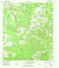
1973 Map of Reklaw
USGS Topo · Published 1976About this map
The Southern Pacific railroad line cuts a diagonal path through this East Texas landscape, connecting the rural communities of Reklaw and Sacul during the early 1970s. The terrain is defined by the complex hydrology of the Angelina River and its numerous tributaries, including the East Fork Angelina River and the winding Mud Creek. This area, straddling the borders of Cherokee, Rusk, and Nacogdoches Counties, reveals a pattern of dispersed settlement and agricultural land punctuated by family-named landmarks like Beard Mtn and Pine Island. Local genealogy is well-represented through several sites of interment, such as Looney Cem, Ward Cem, and Martin Cem. The map also documents the industrial infrastructure of the era, with various pipelines and a Gas Well situated near the southern reach of Atoy Creek.
Find a feature on this map
36 named features on this map. Tap any name to fly to it.
Don’t see what you’re looking for? This feature index may not catch every label — zoom into the map to look around manually.
Map Details
Editions of this 1973 Reklaw Map
This is the sole edition of this map. No revisions or reprints were ever made.
Other maps of this area

1943 · Cushing
USGS Topo · 1:62,500

1943 · Rusk
USGS Topo · 1:62,500

1945 · Cushing
USGS Topo · 1:62,500

1945 · Rusk
USGS Topo · 1:62,500

1946 · Alto
USGS Topo · 1:62,500

1952 · Douglass
USGS Topo · 1:62,500

1953 · Palestine
USGS Topo · 1:250,000

1957 · Palestine
USGS Topo · 1:250,000
1973 · New Summerfield
USGS Topo · 1:24,000

1973 · Cushing
USGS Topo · 1:24,000