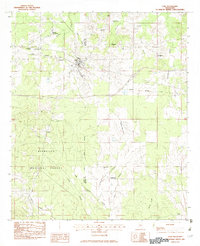
1982 Map of Lake
USGS Topo · Published 1983About this map
The town of Lake serves as the focal point for this survey along the border of Scott and Newton counties. In the early 1980s, the community remained a key node on the Illinois Central Gulf railroad, flanked by smaller hamlets and family-named locales like Dennis Settlement, Little Italy, and Muskegon. The northern portion of the map is defined by a series of creek drainages including Warrior Creek and Barnett Creek, while the southern half is dominated by the dense timberlands of the Bienville National Forest.
Find a feature on this map
31 named features on this map. Tap any name to fly to it.
Don’t see what you’re looking for? This feature index may not catch every label — zoom into the map to look around manually.
Map Details
Editions of this 1982 Lake Map
This is the sole edition of this map. No revisions or reprints were ever made.
Other maps of this area
1921 · Forest
USGS Topo · 1:48,000
1922 · Forest
USGS Topo · 1:62,500
1950 · Forest
USGS Topo · 1:62,500
1952 · Forest
USGS Topo · 1:62,500

1953 · Meridian
USGS Topo · 1:250,000

1957 · Meridian
USGS Topo · 1:250,000

1965 · Meridian
USGS Topo · 1:250,000
1966 · Newton
USGS Topo · 1:24,000
1966 · Decatur NW
USGS Topo · 1:24,000
1968 · Clear Springs
USGS Topo · 1:24,000