
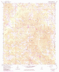
1966 Map of Decatur NW
USGS Topo · Published 1967About this map
The Gulf Mobile and Ohio railroad corridor serves as the primary industrial artery through this Newton County landscape, running adjacent to the small siding at Stratton. This mid-century survey reveals a deeply established rural community defined by its network of local congregations and family burying grounds. Scattered throughout the terrain are landmarks such as Fellowship Ch, Bethlehem Ch, and the Hollingsworth Cem, marking the social centers for residents in outlying areas like Sellers and Jeff. The hydrology of the region is equally complex, dominated by the winding paths of Okohatto Creek and Conehatta Creek. A unique feature of this specific edition is the inclusion of fence and field lines identified through 1964 aerial photography, providing a rare look at mid-century land use and agricultural boundaries that would normally be absent from standard topographic maps.
Find a feature on this map
37 named features on this map. Tap any name to fly to it.
Don’t see what you’re looking for? This feature index may not catch every label — zoom into the map to look around manually.
Map Details
Editions of this 1966 Decatur NW Map
2 editions found
Other maps of this area

1921 · Forest
USGS Topo · 1:48,000

1922 · Forest
USGS Topo · 1:62,500

1950 · Forest
USGS Topo · 1:62,500

1952 · Forest
USGS Topo · 1:62,500

1953 · Meridian
USGS Topo · 1:250,000

1957 · Meridian
USGS Topo · 1:250,000

1965 · Meridian
USGS Topo · 1:250,000

1966 · Hickory
USGS Topo · 1:24,000

1966 · Newton
USGS Topo · 1:24,000

1966 · Decatur
USGS Topo · 1:24,000