
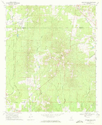
1966 Map of Hickory
USGS Topo · Published 1967About this map
The town of Hickory sits at the intersection of early Southern transportation corridors in Newton County, where the Illinois Central railroad and Route 80 parallel one another across the landscape. By the mid-1960s, the emergence of Interstate 59 introduced a new high-speed thoroughfare north of the established town center, signaling a shift in the regional transit network. The surrounding rural areas are defined by a high density of community landmarks, including the State Experiment Station and several remote houses of worship like Antioch Ch and Poplar Springs Ch.
Find a feature on this map
31 named features on this map. Tap any name to fly to it.
Don’t see what you’re looking for? This feature index may not catch every label — zoom into the map to look around manually.
Map Details
Editions of this 1966 Hickory Map
This is the sole edition of this map. No revisions or reprints were ever made.
Other maps of this area

1953 · Meridian
USGS Topo · 1:250,000

1957 · Meridian
USGS Topo · 1:250,000

1957 · Chunky
USGS Topo · 1:62,500

1957 · Enterprise
USGS Topo · 1:62,500

1965 · Meridian
USGS Topo · 1:250,000

1966 · Newton
USGS Topo · 1:24,000

1966 · Decatur NW
USGS Topo · 1:24,000

1966 · Decatur
USGS Topo · 1:24,000

1970 · Hero
USGS Topo · 1:24,000
1970 · Montrose North
USGS Topo · 1:24,000