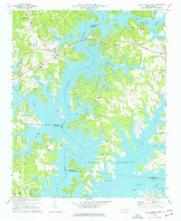
1970 Map of Lake Norman North
USGS Topo · Published 1977About this map
Lake Norman dominates this landscape, its dendritic shoreline reaching deep into the peninsulas of Iredell, Catawba, and Lincoln counties. This 1970 field check captures the region shortly after the reservoir’s creation, showing the transformation of the Catawba River valley. Established rural communities like Sherrills Ford and Terrell sit on the western banks, while the eastern side features the Mooresville Airport and the community of Doolie. The map is particularly useful for genealogists, as it preserves the locations of numerous country houses of worship and burial grounds, including Motts Grove Ch, McKendree Ch, and the Williamson Cem near the water's edge. Industrial and transport infrastructure is also evident, from the Southern railroad tracks to the Powerplant and various boat ramps that signify the area's shift toward a recreation-based economy.
Find a feature on this map
57 named features on this map. Tap any name to fly to it.
Don’t see what you’re looking for? This feature index may not catch every label — zoom into the map to look around manually.
Map Details
Editions of this 1970 Lake Norman North Map
3 editions found
Other maps of this area

1893 · Statesville
USGS Topo · 1:125,000

1895 · Hickory
USGS Topo · 1:125,000

1914 · Gastonia
USGS Topo · 1:48,000

1916 · Gastonia
USGS Topo · 1:62,500

1941 · Charlotte
USGS Topo · 1:125,000

1942 · Charlotte
USGS Topo · 1:125,000

1949 · Hicks Crossroads
USGS Topo · 1:24,000

1953 · Charlotte
USGS Topo · 1:250,000

1954 · Charlotte
USGS Topo · 1:250,000

1960 · Charlotte
USGS Topo · 1:250,000