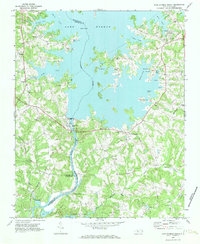
1970 Map of Lake Norman South
USGS Topo · Published 1972About this map
Lake Norman dominates the landscape following the 1965 photogrammetric surveys, having reshaped the central Catawba River corridor. The impoundment of the river created a complex shoreline of coves and inlets, including Ramsey Creek and Hager Creek, which are shown here punctuated by early campgrounds and marinas. At the southern terminus of the lake, the Powerplant and substation at Cowans Ford mark the transition toward Mountain Island Lake. This era shows a community in flux between its agrarian roots and new hydroelectric development. Traditional crossroads and community centers like Hicks Crossroads, Caldwell, and Triangle remain prominent, while many local congregations are documented through churches such as Turrence Chapel, Bethel Ch, and Union Grove Ch. The presence of Allison Ferry and several cemeteries, including Rural Hill Cem, provides significant data for tracing family lineages and early transportation routes before modern infrastructure fully bypassed these older landmarks.
Find a feature on this map
49 named features on this map. Tap any name to fly to it.
Don’t see what you’re looking for? This feature index may not catch every label — zoom into the map to look around manually.
Map Details
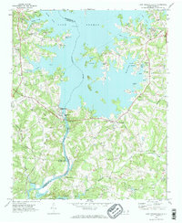
Editions of this 1970 Lake Norman South Map
2 editions found
Other maps of this area

1893 · Statesville
USGS Topo · 1:125,000

1895 · Hickory
USGS Topo · 1:125,000

1914 · Gastonia
USGS Topo · 1:48,000

1916 · Gastonia
USGS Topo · 1:62,500

1941 · Charlotte
USGS Topo · 1:125,000

1942 · Charlotte
USGS Topo · 1:125,000

1948 · Paw Creek
USGS Topo · 1:24,000

1948 · Derita
USGS Topo · 1:24,000

1949 · Hicks Crossroads
USGS Topo · 1:24,000

1953 · Charlotte
USGS Topo · 1:250,000