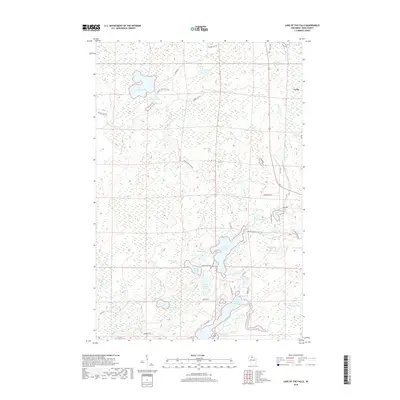
2018 Map of Lake of the Falls
USGS Topo · Published 2018About this map
Lake of the Falls and the surrounding Iron County wetlands define this northern Wisconsin landscape, where the Turtle River feeds into the northern reaches of the Turtle Flambeau Flowage. The map reveals a high density of glacial lakes and marshy lowlands, including the distinctive trio of First Black Lake, Second Black Lake, and Third Black Lake. In the northeast corner, the settlement of Carter sits along Old 51 Rd, representing one of the few concentrated areas of habitation in an otherwise water-dominated geography.
Find a feature on this map
47 named features on this map. Tap any name to fly to it.
Don’t see what you’re looking for? This feature index may not catch every label — zoom into the map to look around manually.
Map Details
Editions of this 2018 Lake of the Falls Map
This is the sole edition of this map. No revisions or reprints were ever made.
Other maps of this area

1940 · Mercer
USGS Topo · 1:48,000

1940 · Butternut
USGS Topo · 1:48,000

1940 · Upson
USGS Topo · 1:48,000

1943 · Upson
USGS Topo · 1:48,000

1943 · Ironwood
USGS Topo · 1:48,000

1945 · Mercer
USGS Topo · 1:48,000

1947 · Butternut
USGS Topo · 1:48,000

1947 · Mercer
USGS Topo · 1:48,000

1950 · Butternut
USGS Topo · 1:48,000

1953 · Ashland
USGS Topo · 1:250,000