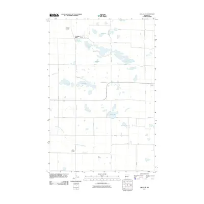
2010 Map of Lake Olaf
USGS Topo · Published 2010About this map
The settlement of Norwegian Grove anchors this portion of Otter Tail County, a landscape defined by its glacial history and dense network of prairie lakes. The map reveals a community deeply rooted in its Scandinavian heritage, evidenced by the cluster of cemeteries including the North Immanuel Cemetery, West North Immanuel Cemetery, and South Immanuel Cemetery. These burial grounds serve as vital points for genealogical research, marking the historic centers of local congregations.
Find a feature on this map
44 named features on this map. Tap any name to fly to it.
Don’t see what you’re looking for? This feature index may not catch every label — zoom into the map to look around manually.
Map Details
Editions of this 2010 Lake Olaf Map
This is the sole edition of this map. No revisions or reprints were ever made.
Other maps of this area

1913 · Fergus Falls
USGS Topo · 1:62,500

1914 · Pelican Rapids
USGS Topo · 1:62,500

1917 · Pelican Rapids
USGS Topo · 1:62,500

1919 · Rothsay
USGS Topo · 1:62,500

1919 · Barnesville
USGS Topo · 1:62,500

1951 · Rothsay
USGS Topo · 1:62,500

1952 · Barnesville
USGS Topo · 1:62,500

1953 · Fargo
USGS Topo · 1:250,000

1956 · Fargo
USGS Topo · 1:250,000
1973 · Lake Olaf
USGS Topo · 1:24,000