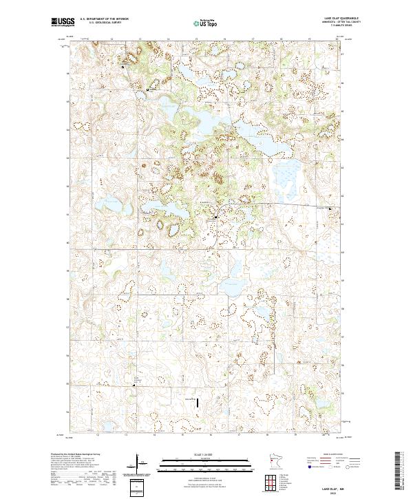
2022 Map of Lake Olaf
USGS Topo · Published 2022About this map
Glacial lakes and small-scale aviation define the landscape of Otter Tail County in this modern record. The area is dotted with numerous water bodies, including Lake Olaf, Grena Lake, and Granrud Lake, which dominate the eastern half of the sheet. For genealogists and local historians, the distribution of denominational and community burial grounds is significant. Sites like Norwegian Grove Cem, North Immanuel Cem, and Ringsaker Cem are scattered across the townships, reflecting the deep-rooted settlement patterns of the region. A notable 21st-century landmark is the Velo Airstrip, located near the southern border, which highlights the continued use of private flight infrastructure in rural Minnesota. The road network, including Co HWY 30 and Co HWY 28, connects these scattered water features and historic sites, providing a clear view of the current land division and transport routes in the township system.
Find a feature on this map
49 named features on this map. Tap any name to fly to it.
Don’t see what you’re looking for? This feature index may not catch every label — zoom into the map to look around manually.
Map Details
Editions of this 2022 Lake Olaf Map
This is the sole edition of this map. No revisions or reprints were ever made.
Other maps of this area

1913 · Fergus Falls
USGS Topo · 1:62,500

1914 · Pelican Rapids
USGS Topo · 1:62,500

1917 · Pelican Rapids
USGS Topo · 1:62,500

1919 · Rothsay
USGS Topo · 1:62,500

1919 · Barnesville
USGS Topo · 1:62,500

1951 · Rothsay
USGS Topo · 1:62,500

1952 · Barnesville
USGS Topo · 1:62,500

1953 · Fargo
USGS Topo · 1:250,000

1956 · Fargo
USGS Topo · 1:250,000
1973 · Lake Olaf
USGS Topo · 1:24,000