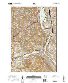
2020 Map of Lake Oswego
USGS Topo · Published 2020About this map
Oswego Lake and its surrounding residential communities anchor this detailed 2020 study of the southern Portland metropolitan area. The landscape is defined by the winding course of the Willamette River, which separates Milwaukie and Oak Grove on the east bank from the affluent enclaves of Dunthorpe and Lake Oswego on the west. This modern era shows a highly developed suburban corridor where major educational institutions like Lewis and Clark College, Reed College, and Marylhurst University are integrated into the hilly terrain.
Find a feature on this map
216 named features on this map. Tap any name to fly to it.
Don’t see what you’re looking for? This feature index may not catch every label — zoom into the map to look around manually.
Map Details
Editions of this 2020 Lake Oswego Map
This is the sole edition of this map. No revisions or reprints were ever made.
Other maps of this area

1897 · Portland
USGS Topo · 1:62,500

1905 · Portland
USGS Topo · 1:62,500

1914 · Oregon City
USGS Topo · 1:62,500

1915 · Hillsboro
USGS Topo · 1:62,500

1916 · Tualatin
USGS Topo · 1:62,500

1918 · Hillsboro
USGS Topo · 1:62,500

1939 · Oregon City
USGS Topo · 1:62,500

1939 · Tualatin
USGS Topo · 1:62,500

1940 · Tualatin
USGS Topo · 1:62,500

1940 · Hillsboro
USGS Topo · 1:62,500