2024 Map of Lake Oswego
USGS Topo · Published 2024About this map
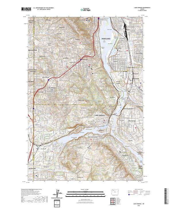
Lake Oswego serves as the central focal point of this regional study, where the Oswego Canal connects the namesake lake to the Tualatin River to the south. The landscape is defined by the winding course of the Willamette River, featuring islands such as Ross Island and Hardtack Island. The map documents a dense network of suburban development and academic institutions, including the sprawling Lewis and Clark College campus near Palatine Hill and Reed College to the northeast. Local history and genealogy are anchored by several prominent burial sites, such as the Beth Israel Cem, Greenwood Hill Cem, and the Milwaukie Pioneer Cem. Industrial and transport legacies are represented by the Southern Pacific RR corridor, which tracks alongside the river through established neighborhoods like Sellwood and Dunthorpe.
Find a feature on this map
110 named features on this map. Tap any name to fly to it.
Don’t see what you’re looking for? This feature index may not catch every label — zoom into the map to look around manually.
Map Details
Editions of this 2024 Lake Oswego Map
This is the sole edition of this map. No revisions or reprints were ever made.