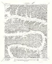
1934 Map of Lake Ozark
USGS Topo · Published 1934About this map
The Bagnell Dam stands as the central engineering feat of this region, having recently impounded the waters of the Lake of the Ozarks. This 1930s survey captures a landscape in transition, where old river valley landmarks like Salt Shoals and the Grand Glaize are newly integrated into a massive reservoir system. The shoreline is already becoming dotted with early recreation and residential sites such as Cooks Camp, Williams Camp, and Lakeview Beach, signaling the area's shift from rural Missouri farmland to a major destination.
Find a feature on this map
48 named features on this map. Tap any name to fly to it.
Don’t see what you’re looking for? This feature index may not catch every label — zoom into the map to look around manually.
Map Details
Editions of this 1934 Lake Ozark Map
3 editions found
Other maps of this area

1888 · Versailles
USGS Topo · 1:125,000

1893 · Versailles
USGS Topo · 1:125,000

1904 · Eldon
USGS Topo · 1:62,500

1904 · Gravois Mills
USGS Topo · 1:62,500

1932 · Versailles No 4
USGS Topo · 1:48,000

1934 · Camdenton
USGS Topo · 1:24,000

1934 · Purvis
USGS Topo · 1:24,000

1934 · Toronto
USGS Topo · 1:24,000

1934 · Lake Ozark
USGS Topo · 1:24,000

1934 · Bagnell
USGS Topo · 1:24,000