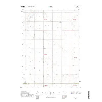
2018 Map of Lake Park SE
USGS Topo · Published 2018About this map
Coteau des Prairies, a prominent glacial upland, dominates this landscape in northwest Iowa. This landform directs the flow of Stony Creek as it meanders southward, eventually crossing the border between Dickinson County and Clay County. The area is characterized by its organized agricultural grid, with section lines marked by routes like Co Hwy A30 and 270th St. Local history is preserved at the Excelsior Township Cem and the Westport Cem, which serve as quiet landmarks for the rural townships of the region. The presence of Stony Lake in the northwest corner highlights the remaining glacial depressions that punctuate this high prairie terrain, showing how water and topography dictated the placement of early farmsteads and transport corridors.
Find a feature on this map
34 named features on this map. Tap any name to fly to it.
Don’t see what you’re looking for? This feature index may not catch every label — zoom into the map to look around manually.
Map Details
Editions of this 2018 Lake Park SE Map
This is the sole edition of this map. No revisions or reprints were ever made.
Other maps of this area

1954 · Fairmont
USGS Topo · 1:250,000

1958 · Fairmont
USGS Topo · 1:250,000

1966 · Spencer
USGS Topo · 1:24,000

1970 · Milford
USGS Topo · 1:24,000

1970 · Everly
USGS Topo · 1:24,000

1970 · Okoboji
USGS Topo · 1:24,000

1970 · Hartley
USGS Topo · 1:24,000

1970 · Lake Park SE
USGS Topo · 1:24,000

1970 · May City
USGS Topo · 1:24,000

1970 · Harris
USGS Topo · 1:24,000