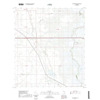
2018 Map of Lake Poinsett NW
USGS Topo · Published 2018About this map
The Saint Johns River serpentines along the eastern edge of this Central Florida landscape, defining the border between Orange and Brevard counties. The terrain is characterized by extensive wetlands and low-lying drainages, including the winding course of Jim Creek and the marshy reaches of Second Creek. High ground is scarce, marked primarily by named elevations such as Long Bluff and Possum Bluff that rise above the river's floodplains.
Find a feature on this map
23 named features on this map. Tap any name to fly to it.
Don’t see what you’re looking for? This feature index may not catch every label — zoom into the map to look around manually.
Map Details
Editions of this 2018 Lake Poinsett NW Map
This is the sole edition of this map. No revisions or reprints were ever made.
Other maps of this area

1949 · Titusville
USGS Topo · 1:24,000

1949 · Sharpes
USGS Topo · 1:24,000

1951 · Sharpes
USGS Topo · 1:24,000

1952 · Titusville
USGS Topo · 1:24,000

1953 · Lake Poinsett
USGS Topo · 1:24,000

1953 · Narcoossee NE
USGS Topo · 1:24,000

1953 · Narcoossee SE
USGS Topo · 1:24,000

1953 · Lake Poinsett SW
USGS Topo · 1:24,000

1953 · Titusville SW
USGS Topo · 1:24,000

1953 · Lake Poinsett NW
USGS Topo · 1:24,000