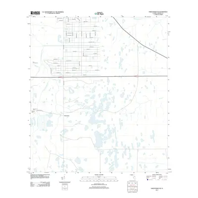
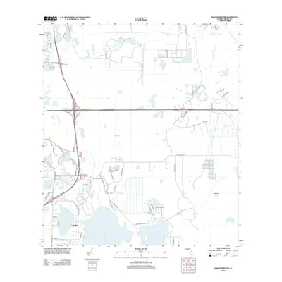
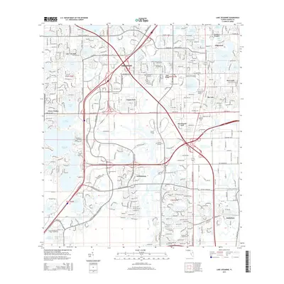
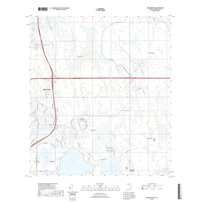
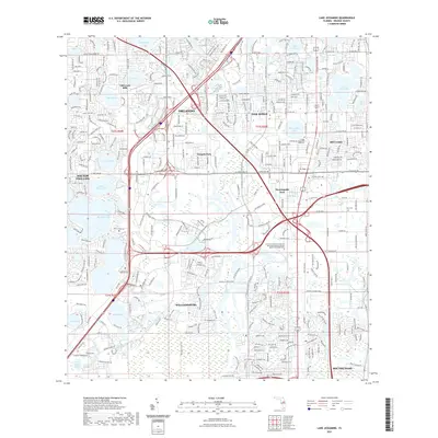
1953 Map of Narcoossee NE
USGS Topo · Published 1954About this map
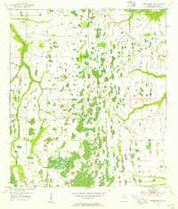
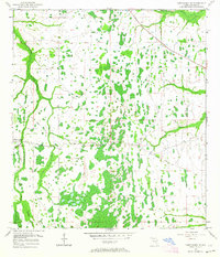
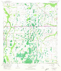
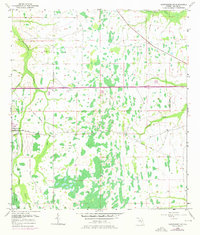
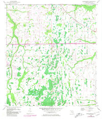
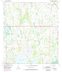
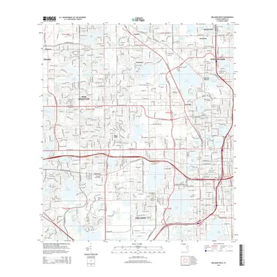
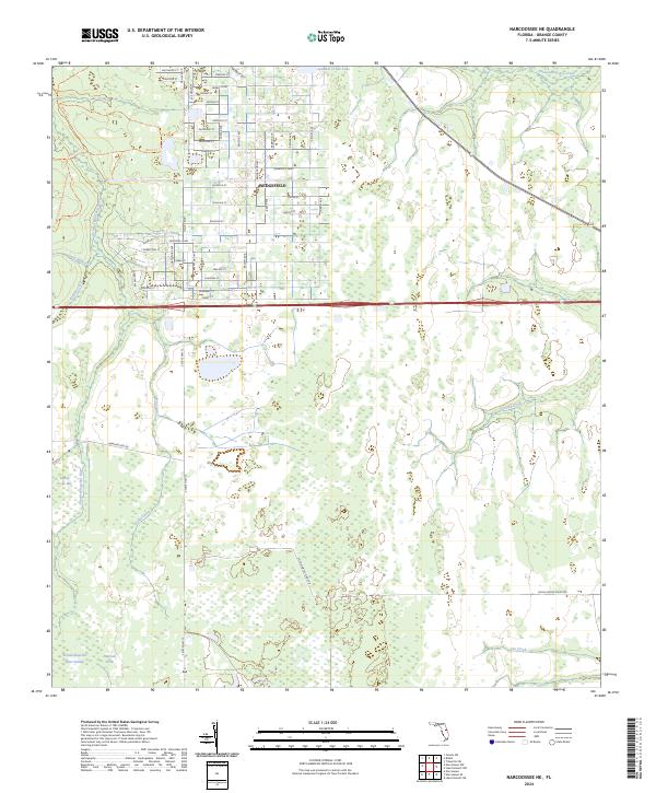
Magnolia Ranch stands as a primary landmark in this rural Orange County landscape during the early 1950s. The area is defined by a complex network of waterways, including the Econlockhatchee River and the Little Econlockhatchee River, which wind through a terrain marked by extensive wetlands and scattered windmills. Evidence of early industrial and transportation efforts is visible in the Old Railroad Grade and the Disston Canal, the latter accompanied by a Spoil Bank indicating significant excavation.
Find a feature on this map
15 named features on this map. Tap any name to fly to it.
Don’t see what you’re looking for? This feature index may not catch every label — zoom into the map to look around manually.
Map Details
Editions of this 1953 Narcoossee NE Map
6 editions found
Historical Maps of Wedgefield Through Time
45 maps found
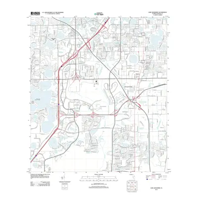
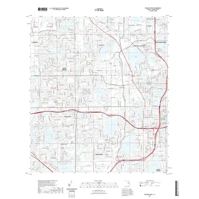
1953 Lake Jessamine
Orange County, FL
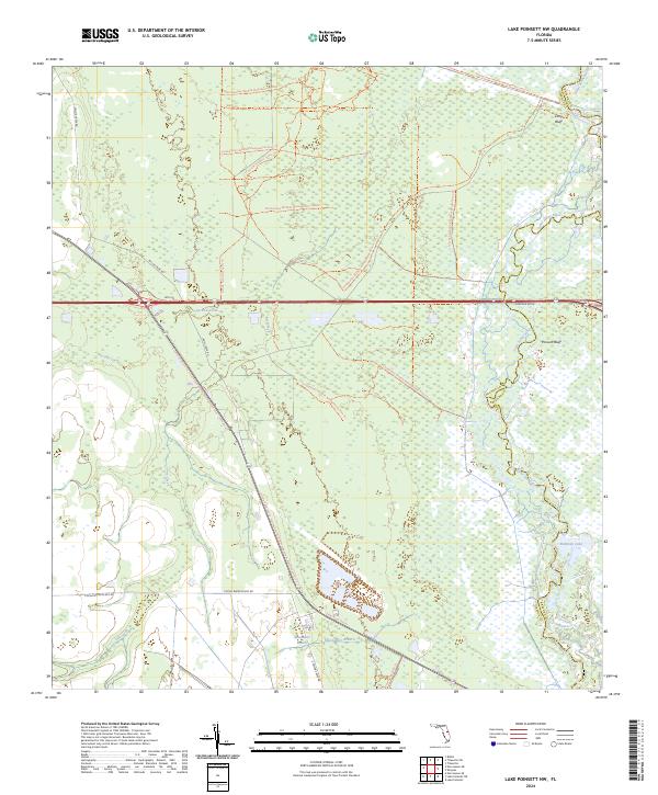
1953 Lake Poinsett NW
Orange County, FL
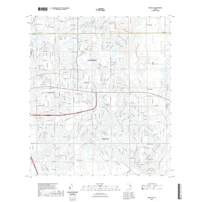
1953 Narcoossee NE
Orange County, FL
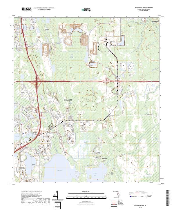
1953 Narcoossee NW
Orange County, FL
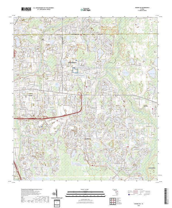
1953 Oviedo SW
Orange County, FL
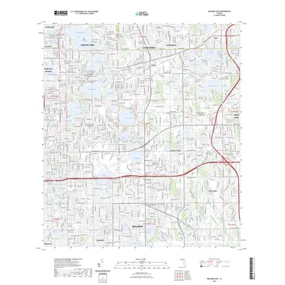
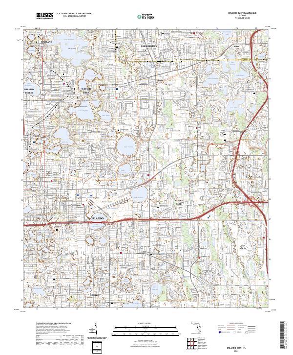
1956 Orlando East
Orange County, FL
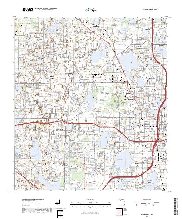
1956 Orlando West
Orange County, FL
1994 Orlando East
Orange County, FL
1995 Orlando West
Orange County, FL
2012 Lake Jessamine
Orange County, FL

2012 Lake Poinsett NW
Orange County, FL
2012 Narcoossee NE
Orange County, FL
2012 Narcoossee NW
Orange County, FL
2012 Orlando East
Orange County, FL
2012 Orlando West
Orange County, FL
2012 Oviedo SW
Orange County, FL
2015 Lake Jessamine
Orange County, FL

2015 Lake Poinsett NW
Orange County, FL
2015 Narcoossee NE
Orange County, FL
2015 Narcoossee NW
Orange County, FL
2015 Orlando East
Orange County, FL
2015 Orlando West
Orange County, FL
2015 Oviedo SW
Orange County, FL
2018 Lake Jessamine
Orange County, FL

2018 Lake Poinsett NW
Orange County, FL
2018 Narcoossee NE
Orange County, FL
2018 Narcoossee NW
Orange County, FL
2018 Orlando East
Orange County, FL
2018 Orlando West
Orange County, FL
2018 Oviedo SW
Orange County, FL
2021 Lake Jessamine
Orange County, FL

2021 Lake Poinsett NW
Orange County, FL
2021 Narcoossee NE
Orange County, FL
2021 Narcoossee NW
Orange County, FL
2021 Orlando East
Orange County, FL
2021 Orlando West
Orange County, FL
2021 Oviedo SW
Orange County, FL
2023 Orlando East
Orange County, FL
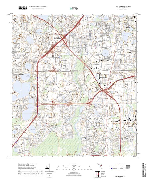
2024 Lake Jessamine
Orange County, FL
2024 Lake Poinsett NW
Orange County, FL
2024 Narcoossee NE
Orange County, FL
2024 Narcoossee NW
Orange County, FL
2024 Orlando East
Orange County, FL
2024 Orlando West
Orange County, FL
2024 Oviedo SW
Orange County, FL