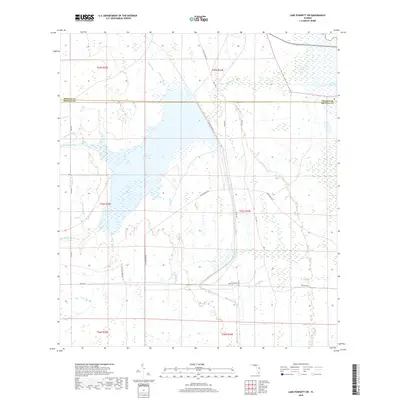
2018 Map of Lake Poinsett SW
USGS Topo · Published 2018About this map
Taylor Cr Reservoir and the headwaters of the St. Johns River system dominate this Central Florida landscape along the border of Orange and Osceola counties. The terrain is characterized by an intricate drainage network including Orange Branch, Beef Camp Br, and Gator Branch, which feed into the wider basin near Lake Poinsett. This 2018 survey reveals a transition between rural land use and water management, with long-standing access routes like Tram Rd and Taylor Woods Rd cutting through the marshy lowlands. The survey highlights the essential hydrology of the region, where numerous small creeks like Cox Creek and Garrett Br converge to form the distinctive wetlands typical of the upper St. Johns River valley. The area remains largely undeveloped, defined by its water bodies and the straight-line section boundaries of the Public Land Survey System.
Find a feature on this map
35 named features on this map. Tap any name to fly to it.
Don’t see what you’re looking for? This feature index may not catch every label — zoom into the map to look around manually.
Map Details
Editions of this 2018 Lake Poinsett SW Map
This is the sole edition of this map. No revisions or reprints were ever made.
Other maps of this area

1949 · Sharpes
USGS Topo · 1:24,000

1951 · Sharpes
USGS Topo · 1:24,000

1953 · Lake Poinsett
USGS Topo · 1:24,000

1953 · Deer Park NE
USGS Topo · 1:24,000

1953 · Narcoossee NE
USGS Topo · 1:24,000

1953 · Narcoossee SE
USGS Topo · 1:24,000

1953 · Deer Park NW
USGS Topo · 1:24,000

1953 · Lake Poinsett SW
USGS Topo · 1:24,000

1953 · Holopaw
USGS Topo · 1:24,000

1953 · Lake Poinsett NW
USGS Topo · 1:24,000