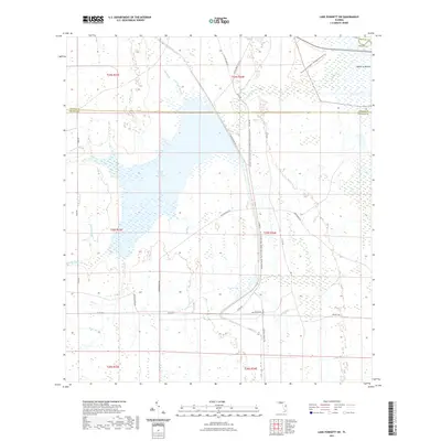
2021 Map of Lake Poinsett SW
USGS Topo · Published 2021About this map
Taylor Creek Reservoir dominates this landscape where Orange, Osceola, and Brevard counties meet in central Florida. The topography is defined by an intricate network of waterways, including Orange Branch, Gator Branch, and Cox Creek, which feed into the primary reservoir system. To the northeast, the Tosohatchee Wildlife Management Area Trail and the distinct elevation of Mulberry Mound provide notable landmarks in an otherwise low-lying wetland environment.
Find a feature on this map
38 named features on this map. Tap any name to fly to it.
Don’t see what you’re looking for? This feature index may not catch every label — zoom into the map to look around manually.
Map Details
Editions of this 2021 Lake Poinsett SW Map
This is the sole edition of this map. No revisions or reprints were ever made.
Other maps of this area

1949 · Sharpes
USGS Topo · 1:24,000

1951 · Sharpes
USGS Topo · 1:24,000

1953 · Lake Poinsett
USGS Topo · 1:24,000

1953 · Deer Park NE
USGS Topo · 1:24,000

1953 · Narcoossee NE
USGS Topo · 1:24,000

1953 · Narcoossee SE
USGS Topo · 1:24,000

1953 · Deer Park NW
USGS Topo · 1:24,000

1953 · Lake Poinsett SW
USGS Topo · 1:24,000

1953 · Holopaw
USGS Topo · 1:24,000

1953 · Lake Poinsett NW
USGS Topo · 1:24,000