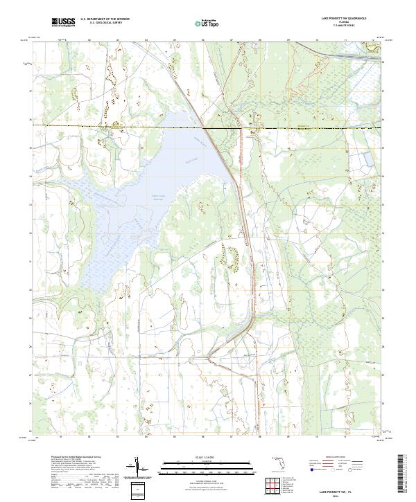
2024 Map of Lake Poinsett SW
USGS Topo · Published 2024About this map
Taylor Creek Reservoir dominates this landscape on the border of Orange and Osceola counties, serving as a central hub for a complex network of waterways. The surrounding wetlands are defined by numerous named tributaries, including North Fork Taylor Creek, South Fork Taylor Creek, and Orange Branch. This area is characterized by low-lying hydrologic features and a sparse road network, reflecting the preserved nature of the central Florida interior. To the northeast, the Tosohatchee Wildlife Management Area Trl indicates a significant conservation footprint. Local transport and land management rely on a series of trails and numbered roads, such as Deseret Ranch Trl and Co Rd 532, which navigate through a mosaic of branches and creeks like Beef Camp Branch and Cox Creek.
Find a feature on this map
35 named features on this map. Tap any name to fly to it.
Don’t see what you’re looking for? This feature index may not catch every label — zoom into the map to look around manually.
Map Details
Editions of this 2024 Lake Poinsett SW Map
This is the sole edition of this map. No revisions or reprints were ever made.
Other maps of this area

1949 · Sharpes
USGS Topo · 1:24,000

1951 · Sharpes
USGS Topo · 1:24,000

1953 · Lake Poinsett
USGS Topo · 1:24,000

1953 · Deer Park NE
USGS Topo · 1:24,000

1953 · Narcoossee NE
USGS Topo · 1:24,000

1953 · Narcoossee SE
USGS Topo · 1:24,000

1953 · Deer Park NW
USGS Topo · 1:24,000

1953 · Lake Poinsett SW
USGS Topo · 1:24,000

1953 · Holopaw
USGS Topo · 1:24,000

1953 · Lake Poinsett NW
USGS Topo · 1:24,000