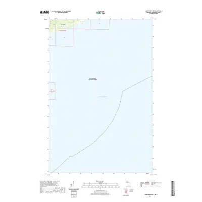
2019 Map of Lake Richie OE S
USGS Topo · Published 2019About this map
Isle Royale National Park encompasses the vast majority of this maritime survey, illustrating the isolated character of this archipelago in northwestern Lake Superior. While mostly water, the map captures a portion of the northern coastline of Isle Royale within township t65n r35w. The cartography emphasizes the park’s wilderness status, showing no established roads or modern developments, which highlights the area's preservation since its establishment. This specific quadrangle provides a detailed perspective on the shoreline and surrounding waters at the end of the second decade of the 21st century, serving as a primary reference for the physical boundaries of the island's northern reaches.
Find a feature on this map
5 named features on this map. Tap any name to fly to it.
Don’t see what you’re looking for? This feature index may not catch every label — zoom into the map to look around manually.
Map Details
Editions of this 2019 Lake Richie OE S Map
This is the sole edition of this map. No revisions or reprints were ever made.
Other maps of this area

1958 · Hancock
USGS Topo · 1:250,000

1959 · Fort William
USGS Topo · 1:250,000

1960 · Hancock
USGS Topo · 1:250,000

1961 · Hancock
USGS Topo · 1:250,000

1966 · Hancock
USGS Topo · 1:250,000

1968 · Fort William
USGS Topo · 1:250,000

1985 · Todd Harbor
USGS Topo · 1:100,000

1985 · Siskiwit Bay
USGS Topo · 1:100,000
1985 · Lake Richie
USGS Topo · 1:24,000
1985 · Todd Harbor
USGS Topo · 1:24,000