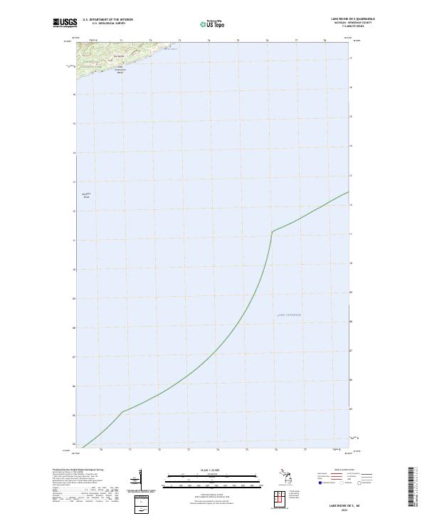
2023 Map of Lake Richie OE S
USGS Topo · Published 2023About this map
Isle Royale National Park dominates this maritime landscape along the northern edge of Lake Superior. The map focuses on a stretch of the shoreline where the Isle Royale Wilderness meets the cold waters of the great lake. Distinctive coastal features include the sheltered Vodrey Harbor and the shoreline at Little Greenstone Beach. Off the coast, the topography extends beneath the waves to define underwater landmarks such as Glenlyon Shoal, which presents a significant hazard for navigation in this portion of the archipelago. This 2023 survey by the U.S. Geological Survey captures the protected character of Isle Royale, showing the intersection of designated wilderness boundaries and the expansive aquatic reaches of the Keweenaw County shoreline.
Find a feature on this map
9 named features on this map. Tap any name to fly to it.
Don’t see what you’re looking for? This feature index may not catch every label — zoom into the map to look around manually.
Map Details
Editions of this 2023 Lake Richie OE S Map
This is the sole edition of this map. No revisions or reprints were ever made.
Other maps of this area

1958 · Hancock
USGS Topo · 1:250,000

1959 · Fort William
USGS Topo · 1:250,000

1960 · Hancock
USGS Topo · 1:250,000

1961 · Hancock
USGS Topo · 1:250,000

1966 · Hancock
USGS Topo · 1:250,000

1968 · Fort William
USGS Topo · 1:250,000

1985 · Todd Harbor
USGS Topo · 1:100,000

1985 · Siskiwit Bay
USGS Topo · 1:100,000
1985 · Lake Richie
USGS Topo · 1:24,000
1985 · Todd Harbor
USGS Topo · 1:24,000