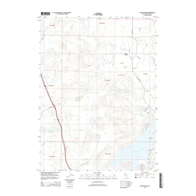
2015 Map of Lake Shastina
USGS Topo · Published 2015About this map
Big Springs serves as a focal point in this northern California landscape, situated where the Shasta River and Big Springs Cr converge. The topography is defined by significant volcanic and hydrologic features, most notably the expansive Lake Shastina to the south and the curiously named Hole in the Ground depression. This 2015 survey illustrates a mix of open range and developing residential tracts, with numerous family-named landmarks such as Stags Leap Ranch Rd and Seldom Seen Ranch Rd hinting at the area's agricultural roots.
Find a feature on this map
53 named features on this map. Tap any name to fly to it.
Don’t see what you’re looking for? This feature index may not catch every label — zoom into the map to look around manually.
Map Details
Editions of this 2015 Lake Shastina Map
This is the sole edition of this map. No revisions or reprints were ever made.
Other maps of this area

1886 · Shasta
USGS Topo · 1:250,000

1894 · Shasta
USGS Topo · 1:250,000

1921 · Shasta Valley Sheet No 7
USGS Topo · 1:24,000

1921 · Shasta Valley Sheet No 11
USGS Topo · 1:24,000

1921 · Shasta Valley Sheet No 1
USGS Topo · 1:24,000

1921 · Shasta Valley Sheet No 6
USGS Topo · 1:24,000

1921 · Shasta Valley Sheet No 2
USGS Topo · 1:24,000

1922 · Shasta Valley Sheet No 10
USGS Topo · 1:24,000

1922 · Shasta Valley Sheet No 1 S
USGS Topo · 1:24,000

1922 · Shasta Valley Sheet No 9
USGS Topo · 1:24,000