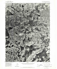
1974 Map of Lake Shastina SW
USGS Topo · Published 1980About this map
Lake Shastina anchors the southeastern corner of this orthophotoquad, revealing the complex water systems of Siskiyou County during the mid-1970s. The photographic imagery captures the stark transition between the reservoir's shoreline and the surrounding agricultural and volcanic landscape. This specific survey documents the flow of the Shastina River and Parks Creek, providing a literal look at the hydrology and land use before subsequent decades of development. North of the lake, the area known as Big Springs stands out against the textured terrain, where field patterns and drainage networks illustrate the region's reliance on these vital water sources. The map serves as a primary record of the surface conditions and parcel boundaries as they existed during the 1974 aerial survey.
Find a feature on this map
4 named features on this map. Tap any name to fly to it.
Don’t see what you’re looking for? This feature index may not catch every label — zoom into the map to look around manually.
Map Details
Editions of this 1974 Lake Shastina SW Map
This is the sole edition of this map. No revisions or reprints were ever made.
Other maps of this area

1886 · Shasta
USGS Topo · 1:250,000

1894 · Shasta
USGS Topo · 1:250,000

1921 · Shasta Valley Sheet No 7
USGS Topo · 1:24,000

1921 · Shasta Valley Sheet No 11
USGS Topo · 1:24,000

1921 · Shasta Valley Sheet No 1
USGS Topo · 1:24,000

1921 · Shasta Valley Sheet No 6
USGS Topo · 1:24,000

1921 · Shasta Valley Sheet No 2
USGS Topo · 1:24,000

1922 · Shasta Valley Sheet No 10
USGS Topo · 1:24,000

1922 · Shasta Valley Sheet No 1 S
USGS Topo · 1:24,000

1922 · Shasta Valley Sheet No 9
USGS Topo · 1:24,000