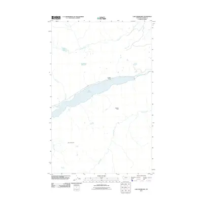
2011 Map of Lake Sherburne
USGS Topo · Published 2011About this map
Lake Sherburne dominates this high-altitude landscape in Glacier County, its elongated form fed by the waters of Swiftcurrent Creek. The 2011 survey reveals a terrain defined by dramatic elevation changes and a complex drainage system, including Kennedy Creek to the north and the southward-flowing Boulder Creek. High points such as Wynn Mountain and the prominent Boulder Ridge frame the watershed, while smaller alpine water bodies like Poia Lake and Swiftcurrent Ridge Lake occupy the higher basins. Along the northern shore of the central reservoir, the road transition at Cassidy Curve provides one of the few named navigational markers in this wilderness area. The map illustrates how glacial geography dictates the path of multiple tributaries, from Windy Creek to Apikuni Creek, all converging toward the central valley.
Find a feature on this map
12 named features on this map. Tap any name to fly to it.
Don’t see what you’re looking for? This feature index may not catch every label — zoom into the map to look around manually.
Map Details
Editions of this 2011 Lake Sherburne Map
This is the sole edition of this map. No revisions or reprints were ever made.
Other maps of this area

1901 · Browning
USGS Topo · 1:125,000

1903 · Browning
USGS Topo · 1:125,000

1904 · Chief Mountain
USGS Topo · 1:125,000

1938 · Chief Mountain
USGS Topo · 1:125,000

1960 · Cut Bank
USGS Topo · 1:250,000

1963 · Cut Bank
USGS Topo · 1:250,000

1964 · Cut Bank
USGS Topo · 1:250,000

1968 · Saint Mary
USGS Topo · 1:24,000

1968 · Gable Mountain
USGS Topo · 1:24,000

1968 · Babb
USGS Topo · 1:24,000