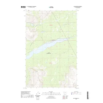
2020 Map of Lake Sherburne
USGS Topo · Published 2020About this map
Glacier National Park defines this landscape, dominated by the expansive Lake Sherburne reservoir and the surrounding peaks of the Rocky Mountains. The map documents the vital infrastructure supporting wilderness access, including the primary corridor of Many Glacier Rd and its distinctive Cassidy Curve. Higher elevations are marked by a network of footpaths, most notably the Continental Divide National Scenic Trail, which skirts the western slopes near Poia Lake. The drainage patterns are clearly delineated, showing how Kennedy Cr and Boulder Cr feed into the central valley. Notable summits such as Wynn Mtn and East Flattop Mtn provide significant vertical relief, while the Sherburne Cutoff offers an alternative route through the dense terrain. This survey provides a precise look at the intersection of early 20th-century water management and modern recreational preservation.
Find a feature on this map
31 named features on this map. Tap any name to fly to it.
Don’t see what you’re looking for? This feature index may not catch every label — zoom into the map to look around manually.
Map Details
Editions of this 2020 Lake Sherburne Map
This is the sole edition of this map. No revisions or reprints were ever made.
Other maps of this area

1901 · Browning
USGS Topo · 1:125,000

1903 · Browning
USGS Topo · 1:125,000

1904 · Chief Mountain
USGS Topo · 1:125,000

1938 · Chief Mountain
USGS Topo · 1:125,000

1960 · Cut Bank
USGS Topo · 1:250,000

1963 · Cut Bank
USGS Topo · 1:250,000

1964 · Cut Bank
USGS Topo · 1:250,000

1968 · Saint Mary
USGS Topo · 1:24,000

1968 · Gable Mountain
USGS Topo · 1:24,000

1968 · Babb
USGS Topo · 1:24,000