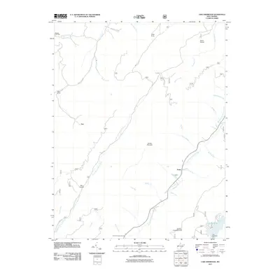
2011 Map of Lake Sherwood
USGS Topo · Published 2011About this map
Lake Sherwood and the surrounding drainage of the Middle Fork Anthonys Creek dominate this 2011 survey of the West Virginia highlands. The landscape is defined by its verticality, with prominent features like Middle Mountain and Meadow Creek Mountain rising between complex creek systems. Small settlements and named locales such as Trainer and Burr are connected by a network of forest roads, including Beaver Creek Rd and Douthat Creek Rd. The presence of Columbia Sulphur Springs points to the region's historic mineral water heritage, while names like May Hollow and Devils Garden reflect local nomenclature. Water management is evident at the Lake Sherwood Dam and the northern Watoga Lake Dam, highlighting the importance of these reservoirs for recreation and conservation in the Monongahela National Forest vicinity.
Find a feature on this map
63 named features on this map. Tap any name to fly to it.
Don’t see what you’re looking for? This feature index may not catch every label — zoom into the map to look around manually.
Map Details
Editions of this 2011 Lake Sherwood Map
This is the sole edition of this map. No revisions or reprints were ever made.
Other maps of this area

1887 · Lewisburg
USGS Topo · 1:125,000

1891 · Lewisburg
USGS Topo · 1:125,000

1891 · Huntersville
USGS Topo · 1:125,000

1894 · Huntersville
USGS Topo · 1:125,000

1894 · Natural Bridge
USGS Topo · 1:125,000

1901 · Monterey
USGS Topo · 1:125,000

1921 · Callaghan
USGS Topo · 1:48,000

1923 · Marlinton
USGS Topo · 1:48,000

1923 · Warm Springs
USGS Topo · 1:48,000

1923 · Callaghan
USGS Topo · 1:62,500