
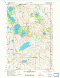
1968 Map of Lake Simon
USGS Topo · Published 1970About this map
Glacial lakes and marshlands dominate this late-1960s landscape at the intersection of Pope, Swift, and Kandiyohi counties. The water-rich terrain of Gilchrist and Kerkhoven townships is defined by significant bodies such as Lake Simon, Scandinavian Lake, and Gilchrist Lake. These basins, often connected by slow-moving water like the Chippewa River East Branch, reflect the post-glacial topography of central Minnesota. Scattered Gravel Pits indicate local industry focused on the area's geological deposits.
Find a feature on this map
30 named features on this map. Tap any name to fly to it.
Don’t see what you’re looking for? This feature index may not catch every label — zoom into the map to look around manually.
Map Details
Editions of this 1968 Lake Simon Map
2 editions found
Other maps of this area

1953 · Saint Cloud
USGS Topo · 1:250,000

1957 · Saint Cloud
USGS Topo · 1:250,000

1958 · Saint Cloud
USGS Topo · 1:250,000

1965 · Sedan
USGS Topo · 1:24,000

1967 · Sunburg
USGS Topo · 1:24,000

1967 · Lake Johanna
USGS Topo · 1:24,000

1968 · De Graff
USGS Topo · 1:24,000

1968 · Terrace
USGS Topo · 1:24,000
1968 · Lake Minnewaska
USGS Topo · 1:24,000
1968 · Swift Falls
USGS Topo · 1:24,000