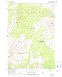
1960 Map of Lake Solitude
USGS Topo · Published 1987About this map
Bighorn National Forest defines this high-altitude landscape, where drainage networks like Paint Rock Creek and Buck Creek carve through the mountains of northern Wyoming. The 1960 survey, updated with 1976 aerial photography, reveals a remote wilderness shaped by seasonal livestock grazing and backcountry travel. Isolated outposts such as Hyatt Cow Camp, Crain Camp, and Buck Creek Cow Camp are positioned near reliable water sources like Bellyache Spring, indicating the area's importance for high-country ranching operations.
Find a feature on this map
32 named features on this map. Tap any name to fly to it.
Don’t see what you’re looking for? This feature index may not catch every label — zoom into the map to look around manually.
Map Details
Editions of this 1960 Lake Solitude Map
4 editions found
Other maps of this area

1899 · Cloud peak
USGS Topo · 1:125,000

1901 · Cloud Peak
USGS Topo · 1:125,000

1955 · Sheridan
USGS Topo · 1:250,000

1958 · Sheridan
USGS Topo · 1:250,000

1960 · Shell Lake
USGS Topo · 1:24,000

1960 · Lake Solitude
USGS Topo · 1:24,000

1960 · Spanish Point
USGS Topo · 1:24,000

1962 · Sheridan
USGS Topo · 1:250,000

1967 · Brokenback Narrows
USGS Topo · 1:24,000
1967 · Meadowlark Lake
USGS Topo · 1:24,000