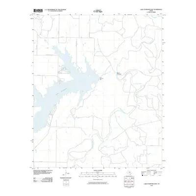
2010 Map of Lake Stamford East
USGS Topo · Published 2010About this map
Lake Stamford dominates this landscape in Haskell and Jones Counties, where the reservoir is contained by the Lake Stamford Dam on its eastern edge. This 2010 survey illustrates the hydrography of the region, including the winding course of Paint Creek and California Creek as they feed into or flow away from the primary water body. The area north of the dam shows the transition from rural ranch land to recreational residential development, specifically along Lakeshore Sites Rd and Shipman Rd. Historically significant for local travel, Scott Crossing is noted where local roads intersect the waterways. The presence of Power Plant Rd on the northern shore indicates the industrial utility of the lake, supporting the region's energy infrastructure and water management systems at the beginning of the twenty-first century.
Find a feature on this map
17 named features on this map. Tap any name to fly to it.
Don’t see what you’re looking for? This feature index may not catch every label — zoom into the map to look around manually.
Map Details
Editions of this 2010 Lake Stamford East Map
This is the sole edition of this map. No revisions or reprints were ever made.
Other maps of this area

1891 · Anson
USGS Topo · 1:125,000

1892 · Albany
USGS Topo · 1:125,000

1893 · Albany
USGS Topo · 1:125,000

1893 · Anson
USGS Topo · 1:125,000

1954 · Abilene
USGS Topo · 1:250,000

1954 · Wichita Falls
USGS Topo · 1:250,000

1958 · Wichita Falls
USGS Topo · 1:250,000

1958 · Abilene
USGS Topo · 1:250,000

1965 · Lueders NW
USGS Topo · 1:24,000

1965 · Lueders NE
USGS Topo · 1:24,000