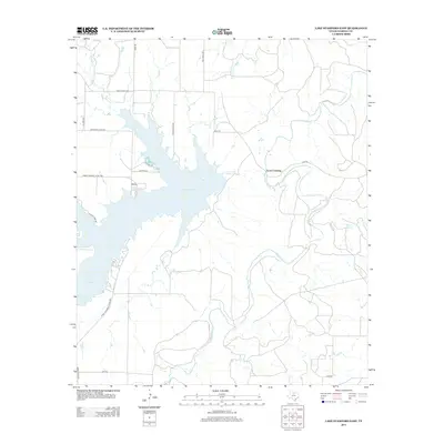
2013 Map of Lake Stamford East
USGS Topo · Published 2013About this map
Lake Stamford dominates this landscape in Haskell County, where the reservoir's fingers reach into the West Texas plains. The map illustrates a rural area defined by water management and access, with Power Plant Rd and Lakeshore Sites Rd indicating the infrastructure and residential development surrounding the lake. Moving away from the shoreline, the terrain is cut by numerous watercourses including Paint Creek and California Creek, which converge in a network of drainage towards the main body of the lake. Small local landmarks like Buffalo Springs and Scott Crossing provide specific points of reference in an otherwise open landscape of ranch roads and farm-to-market routes. The road network, including Ranch Road 2082 and Farm-To-Market Road 3495, reflects the enduring rural character of the region as it appeared in the early 21st century.
Find a feature on this map
20 named features on this map. Tap any name to fly to it.
Don’t see what you’re looking for? This feature index may not catch every label — zoom into the map to look around manually.
Map Details
Editions of this 2013 Lake Stamford East Map
This is the sole edition of this map. No revisions or reprints were ever made.
Other maps of this area

1891 · Anson
USGS Topo · 1:125,000

1892 · Albany
USGS Topo · 1:125,000

1893 · Albany
USGS Topo · 1:125,000

1893 · Anson
USGS Topo · 1:125,000

1954 · Abilene
USGS Topo · 1:250,000

1954 · Wichita Falls
USGS Topo · 1:250,000

1958 · Wichita Falls
USGS Topo · 1:250,000

1958 · Abilene
USGS Topo · 1:250,000

1965 · Lueders NW
USGS Topo · 1:24,000

1965 · Lueders NE
USGS Topo · 1:24,000