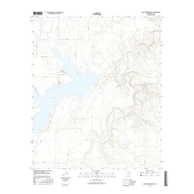
2016 Map of Lake Stamford East
USGS Topo · Published 2016About this map
Lake Stamford dominates the western landscape of this Haskell County region, its irregular shoreline creating a hub for residential and recreational development. A network of local roads such as Lakeshore Sites Rd, Anchor Ln, and Crappie Dr serve the lakeside communities, while Power Plant Rd indicates the industrial utility associated with this water source. East of the reservoir, the terrain is defined by the winding paths of Paint Creek and California Creek, which carve distinct drainage patterns through the Texas plains. The infrastructure is primarily rural, consisting of farm-to-market roads like FM 2082 and FM 3495 that connect isolated homesteads and ranching tracts. This survey provides a clear look at the mid-2010s balance between utility-driven water management and the burgeoning residential pockets clustered along the lake's eastern edge.
Find a feature on this map
21 named features on this map. Tap any name to fly to it.
Don’t see what you’re looking for? This feature index may not catch every label — zoom into the map to look around manually.
Map Details
Editions of this 2016 Lake Stamford East Map
This is the sole edition of this map. No revisions or reprints were ever made.
Other maps of this area

1891 · Anson
USGS Topo · 1:125,000

1892 · Albany
USGS Topo · 1:125,000

1893 · Albany
USGS Topo · 1:125,000

1893 · Anson
USGS Topo · 1:125,000

1954 · Abilene
USGS Topo · 1:250,000

1954 · Wichita Falls
USGS Topo · 1:250,000

1958 · Wichita Falls
USGS Topo · 1:250,000

1958 · Abilene
USGS Topo · 1:250,000

1965 · Lueders NW
USGS Topo · 1:24,000

1965 · Lueders NE
USGS Topo · 1:24,000