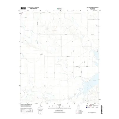
2016 Map of Lake Stamford West
USGS Topo · Published 2016About this map
Lake Stamford dominates the southeastern quadrant of this West Texas landscape, serving as a primary hydrological and recreational center for the surrounding ranchlands. The area's topography is defined by several drainage systems, including Mule Cr and Buffalo Cr, which carve through the plains toward the reservoir. Cultural markers such as the Howard Cem provide specific points of interest for genealogists tracing local family history. The infrastructure is characterized by a dense network of Farm-to-Market roads and rural routes like Mule Creek RD and Greens Camp RD, reflecting the organized transition from open range to modern agricultural and recreational management. The presence of smaller waterways like Rice Springs Br and Stink Cr indicates the natural drainage patterns that have historically shaped land use and boundary lines in this part of Haskell County.
Find a feature on this map
38 named features on this map. Tap any name to fly to it.
Don’t see what you’re looking for? This feature index may not catch every label — zoom into the map to look around manually.
Map Details
Editions of this 2016 Lake Stamford West Map
This is the sole edition of this map. No revisions or reprints were ever made.
Other maps of this area

1891 · Anson
USGS Topo · 1:125,000

1893 · Anson
USGS Topo · 1:125,000

1954 · Abilene
USGS Topo · 1:250,000

1954 · Wichita Falls
USGS Topo · 1:250,000

1958 · Wichita Falls
USGS Topo · 1:250,000

1958 · Abilene
USGS Topo · 1:250,000

1965 · Lueders NW
USGS Topo · 1:24,000

1965 · Lueders NE
USGS Topo · 1:24,000
1965 · Stamford
USGS Topo · 1:24,000

1966 · Haskell
USGS Topo · 1:24,000