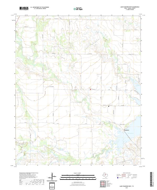
2022 Map of Lake Stamford West
USGS Topo · Published 2022About this map
Lake Stamford dominates the southeastern quadrant of this West Texas landscape, serving as a primary hydrological and recreational center for the city of Stamford. The shoreline is characterized by numerous seasonal access points and residential developments, including Lakeshore Sites Rd, Earles Camp Rd, and Greens Camp Rd. The surrounding terrain in Haskell County is defined by a network of drainage systems feeding the reservoir, notably Buffalo Creek, Mule Creek, and Paint Creek.
Find a feature on this map
41 named features on this map. Tap any name to fly to it.
Don’t see what you’re looking for? This feature index may not catch every label — zoom into the map to look around manually.
Map Details
Editions of this 2022 Lake Stamford West Map
This is the sole edition of this map. No revisions or reprints were ever made.
Other maps of this area

1891 · Anson
USGS Topo · 1:125,000

1893 · Anson
USGS Topo · 1:125,000

1954 · Abilene
USGS Topo · 1:250,000

1954 · Wichita Falls
USGS Topo · 1:250,000

1958 · Wichita Falls
USGS Topo · 1:250,000

1958 · Abilene
USGS Topo · 1:250,000

1965 · Lueders NW
USGS Topo · 1:24,000

1965 · Lueders NE
USGS Topo · 1:24,000
1965 · Stamford
USGS Topo · 1:24,000

1966 · Haskell
USGS Topo · 1:24,000