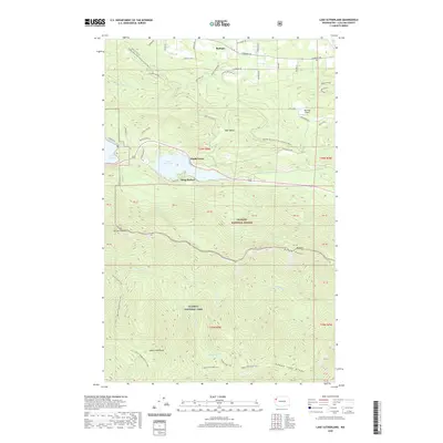
2020 Map of Lake Sutherland
USGS Topo · Published 2020About this map
Lake Sutherland serves as the central focal point of this Olympic Peninsula landscape, where small lakeside communities like Maple Grove and Snug Harbor line the northern and southern shores. This modern survey illustrates the proximity of recreation and preservation, showing where the Olympic Discovery Trail Adventure Route winds through the hills toward Bear Valley. To the south, the terrain rises sharply into the protected wilderness of Olympic National Park, dominated by the steep slopes of Mt Storm King and Baldy Ridge.
Find a feature on this map
72 named features on this map. Tap any name to fly to it.
Don’t see what you’re looking for? This feature index may not catch every label — zoom into the map to look around manually.
Map Details
Editions of this 2020 Lake Sutherland Map
This is the sole edition of this map. No revisions or reprints were ever made.
Other maps of this area

1918 · Lake Crescent
USGS Topo · 1:62,500

1919 · Port Crescent
USGS Topo · 1:62,500

1922 · Lake Crescent
USGS Topo · 1:62,500

1935 · Mount Olympus
USGS Topo · 1:62,500

1939 · Mount Tom
USGS Topo · 1:62,500

1942 · Mount Olympus
USGS Topo · 1:62,500

1950 · Elwha
USGS Topo · 1:24,000

1950 · Hurricane Hill
USGS Topo · 1:24,000

1950 · Lake Sutherland
USGS Topo · 1:24,000
1950 · Angeles Point
USGS Topo · 1:24,000