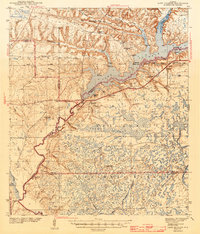
1943 Map of Lake Talquin
USGS Topo · Published 1943About this map
The Ochlockonee River defines the western reaches of this 1943 survey, flowing through the dense wetlands of the Apalachicola National Forest. This era shows the developed shoreline of Lake Talquin punctuated by numerous private landings such as Smith Ldg, Drakes Ldg, and Rawlings Ldg, reflecting a landscape defined by river access and early timber or recreational camps like Camp Star.
Find a feature on this map
61 named features on this map. Tap any name to fly to it.
Don’t see what you’re looking for? This feature index may not catch every label — zoom into the map to look around manually.
Map Details
Editions of this 1943 Lake Talquin Map
2 editions found
Other maps of this area

1940 · Tallahassee
USGS Topo · 1:62,500

1940 · Arran
USGS Topo · 1:62,500

1942 · Tallahassee
USGS Topo · 1:62,500

1943 · Arran
USGS Topo · 1:62,500

1943 · Tallahassee
USGS Topo · 1:62,500

1943 · Lake Talquin
USGS Topo · 1:62,500

1944 · Queens Bay
USGS Topo · 1:24,000

1945 · Smith Creek
USGS Topo · 1:31,680

1945 · Bradwell Bay
USGS Topo · 1:31,680

1945 · Hosford
USGS Topo · 1:31,680