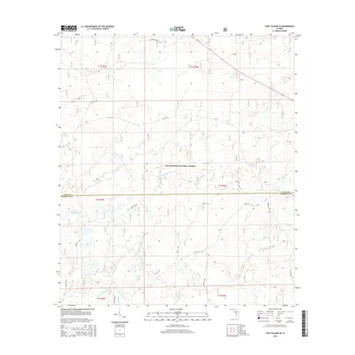
2015 Map of Lake Talquin SE
USGS Topo · Published 2015About this map
The Apalachicola National Forest dominates this landscape south of Lake Talquin, where the headwaters of several coastal river systems emerge from the pine flatwoods. This 2015 survey captures the intricate drainage patterns where the W Br Sopchoppy River and E Br Sopchoppy River converge into the main Sopchoppy River south of the Leon Co Wakulla Co line. Unlike more developed regions, the area is defined by its network of administrative corridors, including National Forest Rd 342 and Nfr 304. These forest roads provide the primary access to the interior wetlands and creek basins like Lost Cr. For the modern researcher, the map reveals the precise intersection of civil boundaries and natural watercourses within a protected Florida wilderness that has remained remarkably consistent in its environmental character.
Find a feature on this map
20 named features on this map. Tap any name to fly to it.
Don’t see what you’re looking for? This feature index may not catch every label — zoom into the map to look around manually.
Map Details
Editions of this 2015 Lake Talquin SE Map
This is the sole edition of this map. No revisions or reprints were ever made.
Other maps of this area

1940 · Tallahassee
USGS Topo · 1:62,500

1940 · Arran
USGS Topo · 1:62,500

1942 · Tallahassee
USGS Topo · 1:62,500

1943 · Arran
USGS Topo · 1:62,500

1943 · Tallahassee
USGS Topo · 1:62,500

1943 · Lake Talquin
USGS Topo · 1:62,500

1945 · Smith Creek
USGS Topo · 1:31,680

1945 · Bradwell Bay
USGS Topo · 1:31,680

1954 · Tallahassee
USGS Topo · 1:250,000

1959 · Tallahassee
USGS Topo · 1:250,000