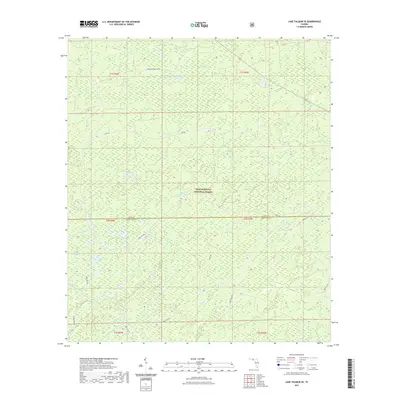
2021 Map of Lake Talquin SE
USGS Topo · Published 2021About this map
Apalachicola National Forest encompasses this entire Florida landscape, revealing a complex network of wetlands and river headwaters. The map centers on the drainage of the Sopchoppy River system, where the E Br Sopchoppy River and West Branch Sopchoppy River begin their southward course. The terrain is defined by numerous shallow depressions known as bays, including Wolf Trap Bay, Grand Bay, and Freeman Bay, which are characteristic of the flatwood and cypress swamp ecosystems of the region. This 2021 survey traces the modern boundary between Leon County and Wakulla County, which bisects the forest. The absence of traditional towns highlights the area's role as a protected wilderness, managed through a grid of numbered roads such as NFR 304 and Forest RD 306 that serve forestry and recreation rather than permanent settlement.
Find a feature on this map
24 named features on this map. Tap any name to fly to it.
Don’t see what you’re looking for? This feature index may not catch every label — zoom into the map to look around manually.
Map Details
Editions of this 2021 Lake Talquin SE Map
This is the sole edition of this map. No revisions or reprints were ever made.
Other maps of this area

1940 · Tallahassee
USGS Topo · 1:62,500

1940 · Arran
USGS Topo · 1:62,500

1942 · Tallahassee
USGS Topo · 1:62,500

1943 · Arran
USGS Topo · 1:62,500

1943 · Tallahassee
USGS Topo · 1:62,500

1943 · Lake Talquin
USGS Topo · 1:62,500

1945 · Smith Creek
USGS Topo · 1:31,680

1945 · Bradwell Bay
USGS Topo · 1:31,680

1954 · Tallahassee
USGS Topo · 1:250,000

1959 · Tallahassee
USGS Topo · 1:250,000