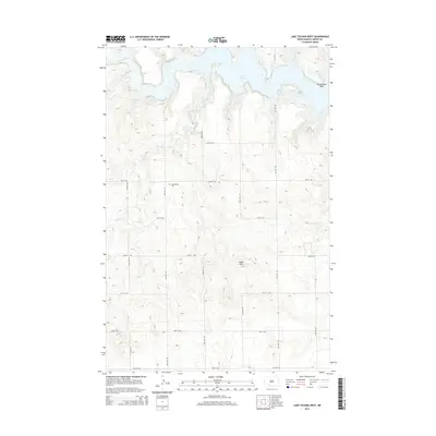
2014 Map of Lake Tschida West
USGS Topo · Published 2014About this map
Lake Tschida dominates the northern reaches of this Grant County landscape, where the waters of the Heart River are contained within the undulating prairie. The reservoir's shoreline is defined by prominent landmarks such as Rattlesnake Point and fed by numerous tributaries including Spring Cr, Coal Cr, and Sled Cr. This digital-era survey reveals the highly organized section-line road network that overlays the terrain, where routes like 75th Ave SW and 63rd St SW intersect a landscape of rolling rises and localized drainage basins.
Find a feature on this map
22 named features on this map. Tap any name to fly to it.
Don’t see what you’re looking for? This feature index may not catch every label — zoom into the map to look around manually.
Map Details
Editions of this 2014 Lake Tschida West Map
This is the sole edition of this map. No revisions or reprints were ever made.
Other maps of this area

1938 · Heart Butte
USGS Topo · 1:48,000

1944 · Heart Butte
USGS Topo · 1:62,500

1953 · Dickinson
USGS Topo · 1:250,000

1954 · Bismarck
USGS Topo · 1:250,000

1957 · Dickinson
USGS Topo · 1:250,000

1958 · Bismarck
USGS Topo · 1:250,000

1960 · Heart Butte NW
USGS Topo · 1:24,000

1960 · Clark Butte NE
USGS Topo · 1:24,000

1960 · Heart Butte
USGS Topo · 1:24,000

1960 · Clark Butte
USGS Topo · 1:24,000