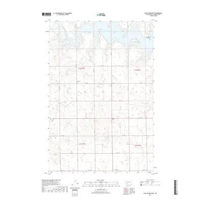
2017 Map of Lake Tschida West
USGS Topo · Published 2017About this map
The Heart River winds through this section of Grant County, feeding into the expansive western waters of Lake Tschida. The surrounding landscape is defined by the high ground of the Stone Hills and prominent landmarks like Rattlesnake Point, which overlooks the northern reaches of the reservoir. This 2017 survey reflects the contemporary rural grid of North Dakota, where deep coulees and drainages such as Coal Cr, Sled Cr, and Sugm Cr cut through the high plains toward the river valley.
Find a feature on this map
26 named features on this map. Tap any name to fly to it.
Don’t see what you’re looking for? This feature index may not catch every label — zoom into the map to look around manually.
Map Details
Editions of this 2017 Lake Tschida West Map
This is the sole edition of this map. No revisions or reprints were ever made.
Other maps of this area

1938 · Heart Butte
USGS Topo · 1:48,000

1944 · Heart Butte
USGS Topo · 1:62,500

1953 · Dickinson
USGS Topo · 1:250,000

1954 · Bismarck
USGS Topo · 1:250,000

1957 · Dickinson
USGS Topo · 1:250,000

1958 · Bismarck
USGS Topo · 1:250,000

1960 · Heart Butte NW
USGS Topo · 1:24,000

1960 · Clark Butte NE
USGS Topo · 1:24,000

1960 · Heart Butte
USGS Topo · 1:24,000

1960 · Clark Butte
USGS Topo · 1:24,000