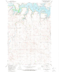
1980 Map of Lake Tschida West
USGS Topo · Published 1980About this map
The Heart River valley in Grant County underwent significant change following the mid-century construction of the dam that created the Heart Butte Reservoir, also known as Lake Tschida. This 1980 survey documents the expansive water body and the surrounding Heart Butte Reservoir State Game Management Area, which preserves the habitat around the winding northern shoreline. South of the reservoir, the terrain rises into the Stone Hills, a landscape marked by intermittent drainages including Coal Creek, Sled Creek, and Schatz Creek.
Find a feature on this map
17 named features on this map. Tap any name to fly to it.
Don’t see what you’re looking for? This feature index may not catch every label — zoom into the map to look around manually.
Map Details
Editions of this 1980 Lake Tschida West Map
This is the sole edition of this map. No revisions or reprints were ever made.
Other maps of this area

1938 · Heart Butte
USGS Topo · 1:48,000

1944 · Heart Butte
USGS Topo · 1:62,500

1953 · Dickinson
USGS Topo · 1:250,000

1954 · Bismarck
USGS Topo · 1:250,000

1957 · Dickinson
USGS Topo · 1:250,000

1958 · Bismarck
USGS Topo · 1:250,000

1960 · Heart Butte NW
USGS Topo · 1:24,000

1960 · Clark Butte NE
USGS Topo · 1:24,000

1960 · Heart Butte
USGS Topo · 1:24,000

1960 · Clark Butte
USGS Topo · 1:24,000