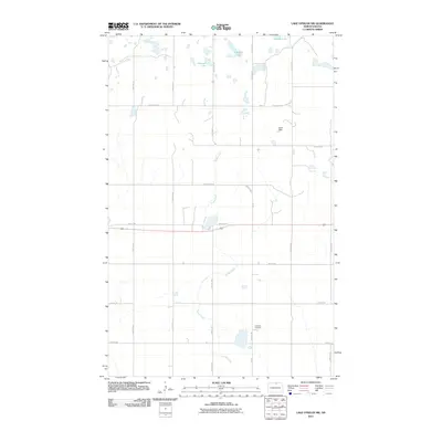
2011 Map of Lake Upsilon SW
USGS Topo · Published 2011About this map
Snake Creek meanders through this portion of Rolette County, creating a hydrological network characterized by prairie potholes and small reservoirs. The landscape is defined by its rural road grid, including routes like Poker Hill Rd and Jack Rabbit Rd, which navigate the wetlands and glacial depressions of the Turtle Mountain region. Significant water bodies such as Howard Lake, Johnson Lake, and Cassidy Lake dominate the northern terrain, while the Azure Dam represents local water management efforts. Central to the local community is the Lakeview Cemetery, situated near a bend in the creek and accessed via Bia 23. This 2011 survey captures the area's agricultural and tribal land distribution, as indicated by the numerous Bureau of Indian Affairs routes like BIA Road 13 and BIA Road 23 that crisscross the prairie.
Find a feature on this map
26 named features on this map. Tap any name to fly to it.
Don’t see what you’re looking for? This feature index may not catch every label — zoom into the map to look around manually.
Map Details
Editions of this 2011 Lake Upsilon SW Map
This is the sole edition of this map. No revisions or reprints were ever made.
Other maps of this area

1935 · Dunseith
USGS Topo · 1:48,000

1936 · Lake Upsilon
USGS Topo · 1:48,000

1939 · Dunseith
USGS Topo · 1:62,500

1942 · Lake Upsilon
USGS Topo · 1:62,500

1953 · Devils Lake
USGS Topo · 1:250,000

1954 · Minot
USGS Topo · 1:250,000

1955 · Fonda
USGS Topo · 1:24,000

1955 · Thorne
USGS Topo · 1:24,000

1955 · Dunseith
USGS Topo · 1:24,000

1955 · Lake Upsilon SW
USGS Topo · 1:24,000